Media inquiries contact:
Jessica Spatafore, Director of Development & Communications at (304) 413-0945 or email jessica@wvlandtrust.org
Adam Webster, Conservation & Communications Coordinator at (304) 413-0945 or email adam@wvlandtrust.org
Story by Rick Steelhammer at Charleston Gazette-Mail.
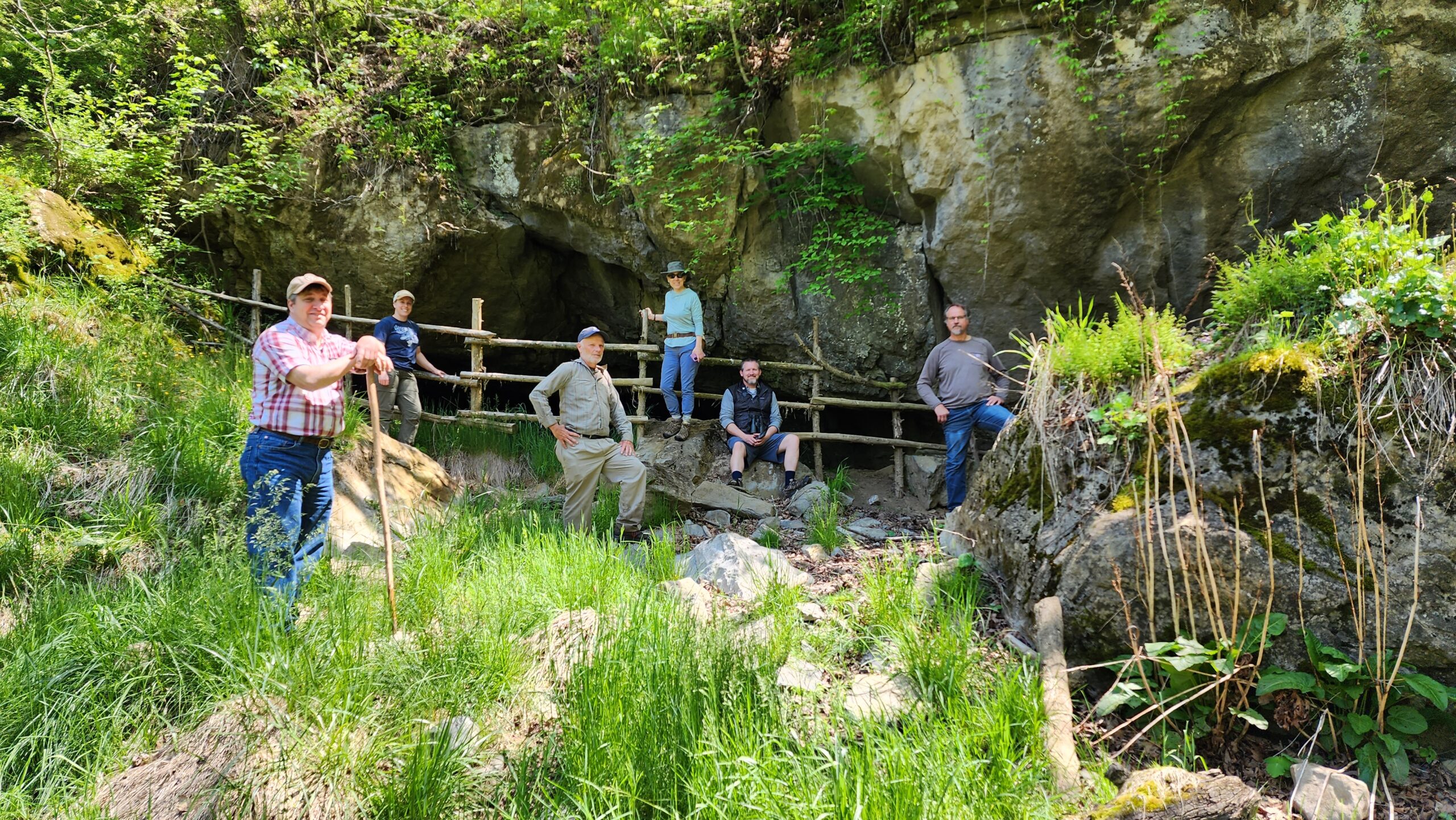
The West Virginia Land Trust has assumed management of a historic Monroe County cave system.
The cave was once mined for saltpeter by pioneer settlers and Confederate soldiers. Saltpeter is a key component in the making of gunpowder. The cave now provides habitat for at least two endangered bat species.
Partial funding for the preserve was made available as habitat impact mitigation arising from construction of the Mountain Valley Pipeline, which passes just west of Greenville.
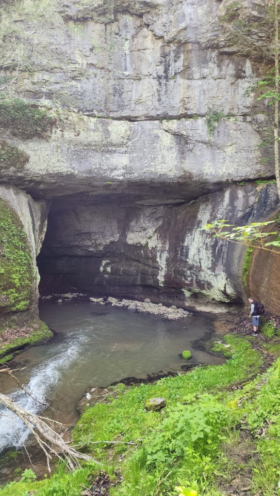
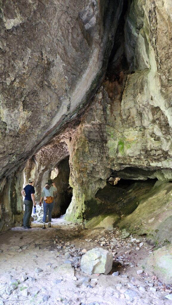
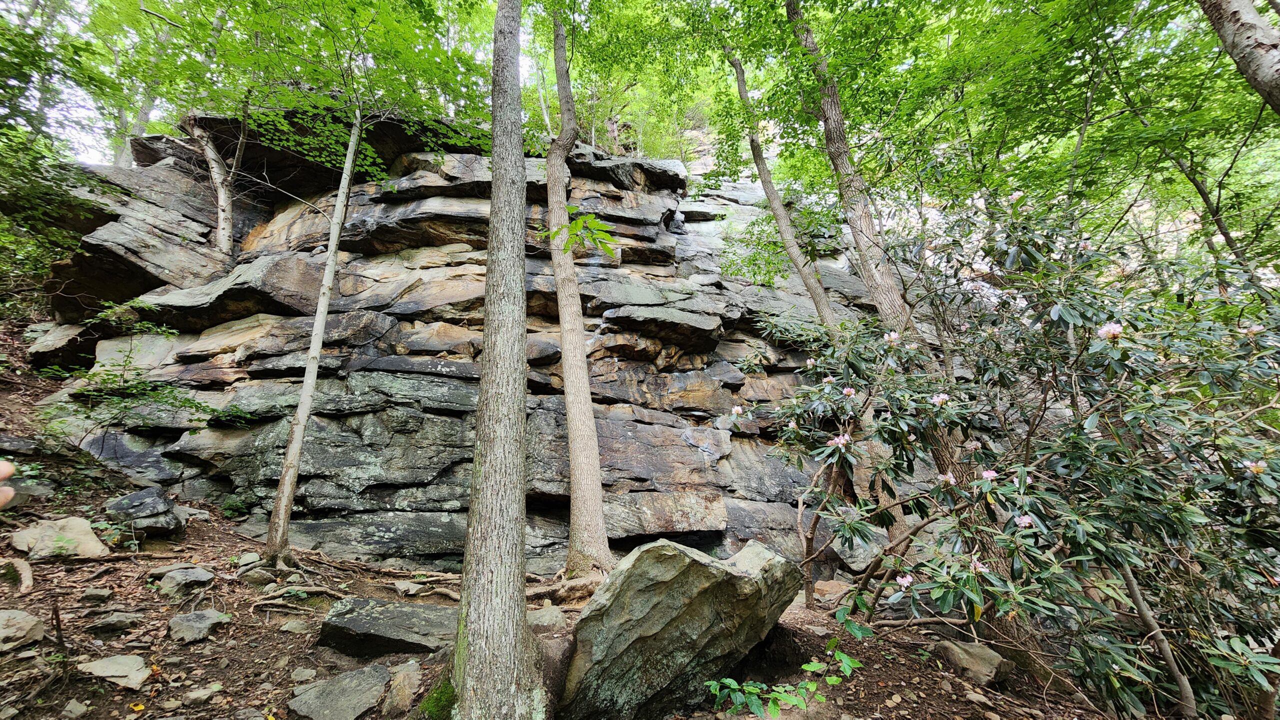
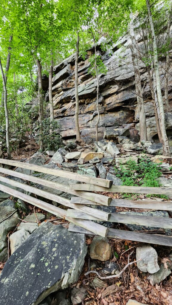
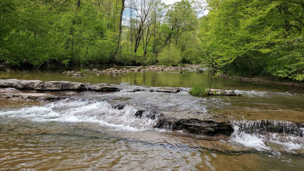
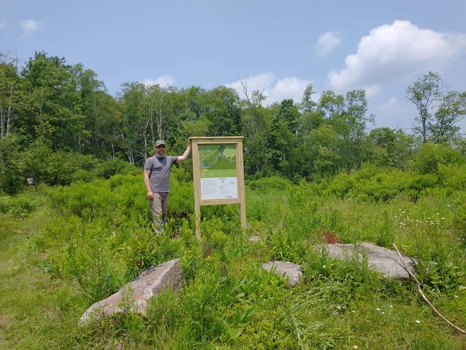
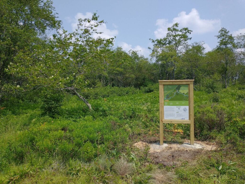
The new, 298-acre Greenville Saltpeter Cave Preserve encompasses its namesake limestone cavern, which contains nearly 4 miles of mapped passages.
Prime habitat for bats
The cave provides prime habitat for endangered Indiana and Northern long-eared bats during their breeding and hibernation seasons, which extend from late summer to early spring. The cave also shelters one of the largest surviving populations of the tricolored bat, which is under review for Endangered Species Act protection.
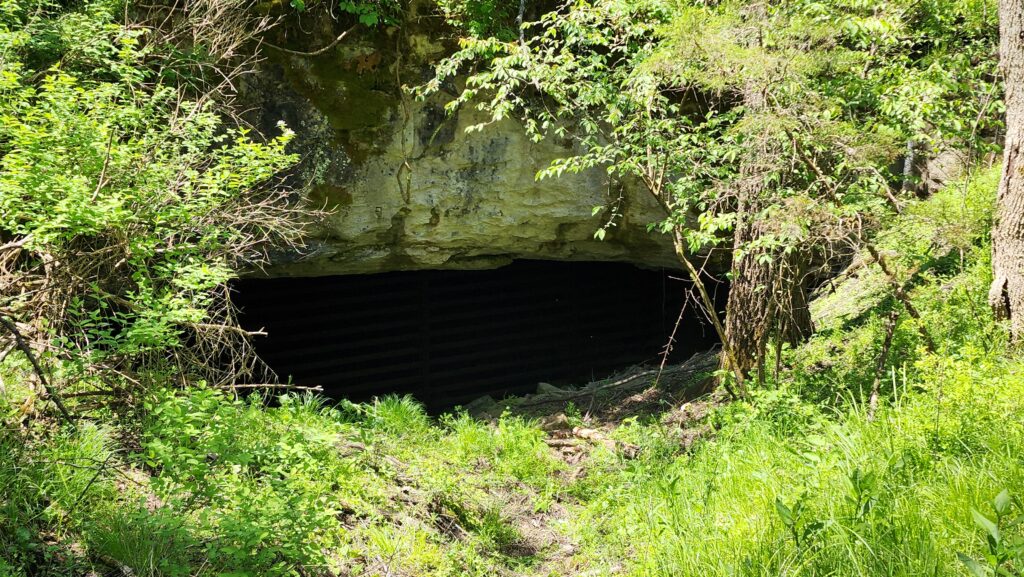
The preserve, to be managed in cooperation with the West Virginia Division of Natural Resources and the U.S. Fish and Wildlife Service, will be the first site in the Mountain State where a promising experimental treatment designed to reduce bats’ vulnerability to white-nose syndrome will be deployed. A fungal disease that has brought about precipitous declines in bat populations since it appeared in the United States in 2006, white-nose syndrome disrupts hibernation, causing dehydration, starvation and often death.
DNR biologists will bathe in ultraviolet light the ceilings and walls where hibernating bats congregate in large numbers in Greenville Saltpeter Cave. The UV light is a wavelength capable of neutralizing the pathogen that causes the disease. The UV-C light has a minimal effect on other cave-dwelling organisms, and after it is applied, leaves no trace residue within the cave.
“UV-C light treatment is a cutting-edge process,” said Alex Silvis, the DNR biologist who led the white-nose syndrome treatment project. “I am enthusiastic the results will be positive and the UV-C light method will become standard practice in reducing white-nose syndrome.”
Acquisition process, and history of the caves
The preserve was acquired by The Conservation Fund, a national nonprofit involved with land and water protection. The DNR asked the organization to negotiate with the tract’s two private landowners, with the understanding that the land would become a cave preserve. Ownership of the land was then transferred to the West Virginia Land Trust.
“The biological and historical value of this land made it clear to everyone involved that permanent conservation was more than just prudent — it was paramount,” said Joe Hankins of Shepherdstown, vice president of The Conservation Fund, as well as the organization’s state director.
“Our partners at West Virginia Land Trust will serve as unparalleled caretakers for this land,” Hankins said. “We’re thrilled to have helped secure this outcome, which will benefit West Virginians for decades to come.”
The nonprofit Institute for Earth Education, which owned half of the land that makes up the new preserve and had begun a conservation stewardship program for the cave system, will partner with the Land Trust on educational and interpretive programs at the preserve.
“These caves have long held a special place in the hearts of those living in Monroe County and beyond,” said Amanda Sandell, who owned the other half of the preserve’s acreage. “May this protection serve to preserve the caves for generations to come.”
From 1777 until the start of the Civil War, the Greenville Saltpeter Cave was mined extensively for saltpeter, a key ingredient in the manufacture of gunpowder. During the Civil War, the cave was mined to help keep the Confederate army supplied with gunpowder.
In the 18th and 19th centuries, one entrance to the cavern, known as the Singing Cave, was used by church groups for gospel sings, because of its favorable acoustics.
In his 1958 book, “Caverns of West Virginia,” geologist William Davies William wrote that “cart ruts, burro tracks, mattock marks and other relics of saltpeter operations” could be found inside the Greenville Saltpeter Cave. However, many of those remnants have since been removed, damaged or destroyed by vandals, according to the Land Trust.
Public access to the preserve
The previous owners of the preserve’s property, following recommendations by the DNR and U.S. Fish and Wildlife Service, installed gates at the cave’s five entrances to restrict human access in an effort to prevent the spread of white-nose syndrome.
While the cave is expected to remain closed to the public for a number of years, the surface portion of the preserve may be open for public hiking, bird-watching, nature study and photography after the DNR’s UV-C project is completed.
The Land Trust will work with the DNR, Fish and Wildlife and the Institute for Earth Education on a plan to safely open the property to the public, according to a release from the Land Trust.
Funding for new preserve was made possible through a voluntary stewardship agreement between the DNR, the West Virginia Land Trust, The Conservation Fund and Mountain Valley Pipeline LLC. The agreement provided funds to buy and manage land for the preserve and fund the West Virginia DNR’s bat research project in the cave.
Story by Rick Steelhammer at Charleston Gazette-Mail: https://www.wvgazettemail.com/outdoors/recreation/wv-land-trust-to-preserve-manage-historic-monroe-county-cave/article_9ecc7ec4-109f-581e-bbea-5a13b2ad9b2a.html
Story by Steve Keenan at Register-Herald.
The West Virginia Land Trust (WVLT) recently secured permanent access to a popular rock climbing area in the New River Gorge region.
A local climbing representative says the access acquisition is a major benefit for locals and visitors alike who pursue their passion for climbing.
According to a WVLT press release, the climbing area known as “Bubba City” or “Sandstonia” borders the New River Gorge National Park and Preserve near Fayetteville.
A 40-acre WVLT-owned preserve now called “Gateway to Sandstonia” is within a few miles of the National Park Service Visitor Center and provides recreational access to a nearly 2-mile rock wall that offers dozens of climbing routes, as well as hiking opportunities and scenic views, the release noted. The rock wall known as Sandstonia is located on New River Gorge National Park and Preserve property.
“WVLT has put the ‘public’ in public lands,” Gene Kistler, founder of the New River Alliance of Climbers and a former owner of Water Stone Outdoors, said via the release. “This strategic acquisition that connects a public road to the national park secures recreational access to miles of awesome Nuttall sandstone cliff.
“The climbing community is psyched to help create a trailhead and maintain this gift.”
“New River has over 1,400 named rock climbs and has become one of the most popular rock climbing destinations in the country,” Charles Sellars, superintendent of New River Gorge National Park and Preserve, said in the release. “Providing safe and environmentally conscious access points is vital to our visitors and our resource.”
“This project is important because it secures land that ensures permanent access to a climbing area in the New River National Park and Preserve,” Adam Webster, conservation project manager for the West Virginia Land Trust, said in an email. “We will be working with local partners like the New River Alliance of Climbers to develop the parking area and new climbing access trail in upcoming months.
“This project will not only provide a permanent access solution for a popular climbing area within the New River National Park and Preserve, it will also open our property up for other visitors to go hiking, birding or to explore a new recreation space along the rim of the New River Gorge,” Webster continued. “This project is important because it allows the Land Trust to help local partners, like New River Alliance of Climbers, to secure access to a climbing area that has been important to the recreation community for many years.
“It also gives us a chance to work with them to develop the trails on the property and expand opportunities for other users like hikers, birders and people just wanting to get outdoors.”
According to the press release, climbers have known about the rock formations to the north of the New River Gorge Bridge for many years, but gaining access across private land has been an ongoing challenge. Gateway to Sandstonia will temper that scenario and serve as the permanent access that locals and visitors have envisioned for years, officials said.
Future plans for the property include parking, signage and hiking opportunities. The preserve will be developed with support from donations and local volunteers, the release noted. For those who want to get involved in development of the area, email jessica@wvlandtrust.org.
Webster stressed that the area is not immediately open to the public and that the WVLT plans to work with local partners to develop the parking area, signs and trails. Climbers can use the existing accesses to “Sandstonia/Bubba City” climbing areas, he said, but officials will encourage people to transition away from the existing roadside accesses that are on private property to the Land Trust property once construction of access features (parking, etc.) is completed.
Story by Steve Keenan at Register-Herald: https://www.register-herald.com/news/permanent-access-secured-for-rock-climbing-area/article_c409231a-9056-11ee-b7b7-3b547acd7d6c.html
Story by Matt Harvey at WV News
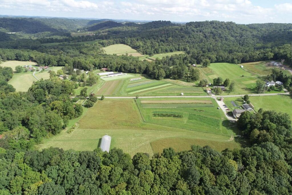
A 70-acre farm in fast-growing Monongalia County has been protected permanently, keeping the property’s streams, forest, and farmland safe for agricultural production and scenic enjoyment for years to come.
The West Virginia Land Trust, together with Linda Yoder, owner of Owl Creek Farm, completed the land protection project after signing the county’s first farmland conservation easement.
“Linda’s efforts to protect her property are significant not only because it is Monongalia County’s first-ever agricultural conservation easement, but also because it keeps the property from being subdivided or developed. The property protects agricultural land of statewide significance, conserves forest land, and protects a stream that is within a drinking water protection area for the Morgantown Utility Board,” said Adam Webster, WV Land Trust Conservation Project manager.
According to the Land Trust, Yoder leases part of the conserved property to Mountain Harvest Farm, which was recently awarded as West Virginia’s “2023 Conservation Farm of the Year.”
Mountain Harvest Farm is operated by Mary Oldham and Chico Ramirez, who operate an organic farm that sells produce at the Morgantown Farmers Market and through a community supported agriculture program.
“When I first set foot on this beautiful land in 1976, walked up a streambed, and smelled the pennyroyal underfoot, I felt this was a special place. The dream of sustaining it began to grow,” Yoder said.
The Owl Creek Farm property is protected by a legal mechanism, known as a conservation easement, which is a voluntary agreement with a landowner that permanently limits uses of the land in order to protect its conservation values.
“The types of land uses or conservation values that the West Virginia Land Trust typically works with landowners to protect include agricultural or rural landscapes, riverside habitats and water quality, historical sites, unique habitats important for wildlife, land adjacent to other public properties, and those places that provide recreational opportunities for the public or otherwise provide a community benefit,” Webster said.
According to the American Farmland Trust, the United States is losing 2.2 million acres of rural lands to urban sprawl every year. This means that across the United States more than an acre of agricultural land is lost every single second. West Virginia has not escaped the loss of farmland. From 1964 to 2012, The U.S. Department of Agriculture reported that West Virginia lost 13,480 farms and 1,671,918 acres of farmland.
“Protecting our farm is just one piece of a bigger conservation puzzle that needs to be pieced together in our local area, across West Virginia, and the nation. We are happy to be part of a solution that makes this land available for future generations to farm and learn about the outdoors,” Yoder said.
Story by Matt Harvey at WV News: https://www.wvnews.com/morgantownnews/news/local/monongalia-farm-protected-with-county-s-first-agricultural-conservation-easement/article_b9a35f96-8497-11ee-8156-3b5c7d645eca.html
Story by Rick Steelhammer at Charleston Gazette-Mail.
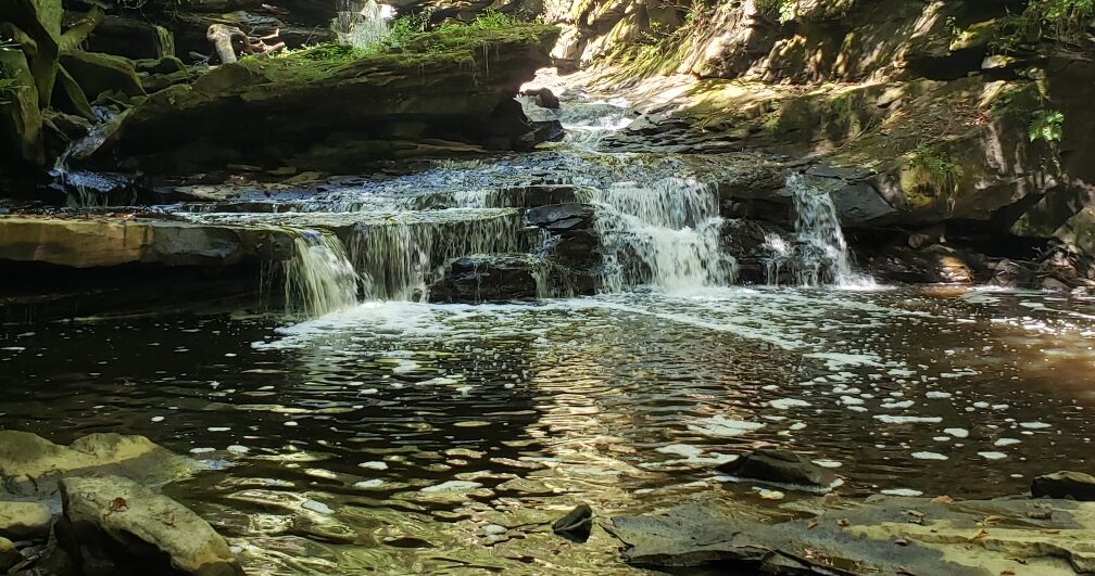
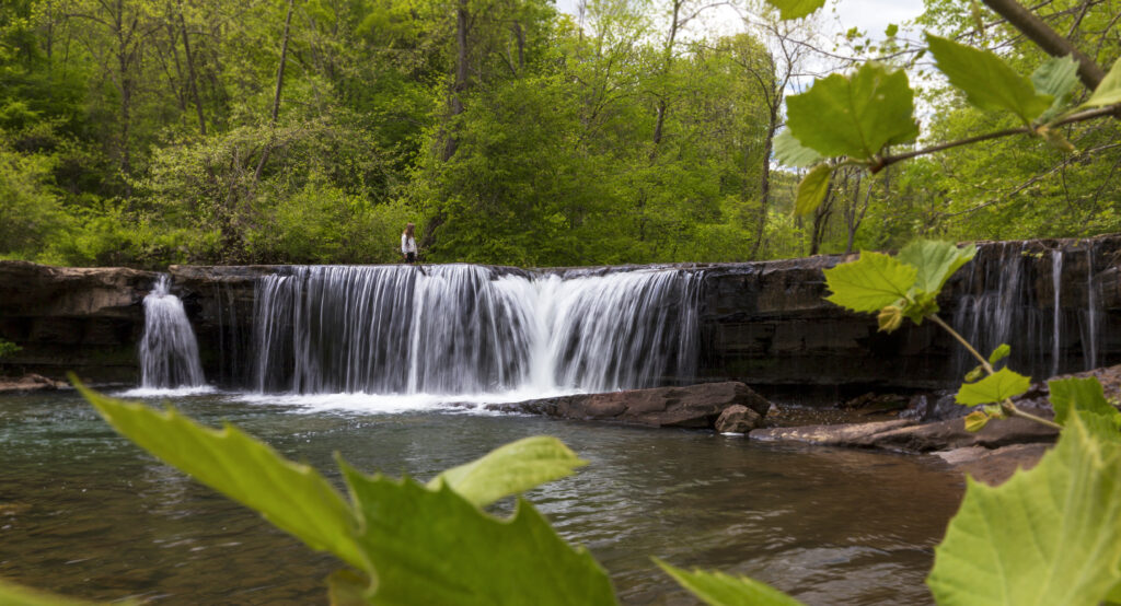
A few minutes’ drive from downtown Beckley, Cranberry Creek and Little White Stick Creek meander off a plateau and tumble down their steep, rocky streambeds, forming waterfalls and plunge pools as they cascade into the West Virginia Land Trust’s Piney Creek Preserve.
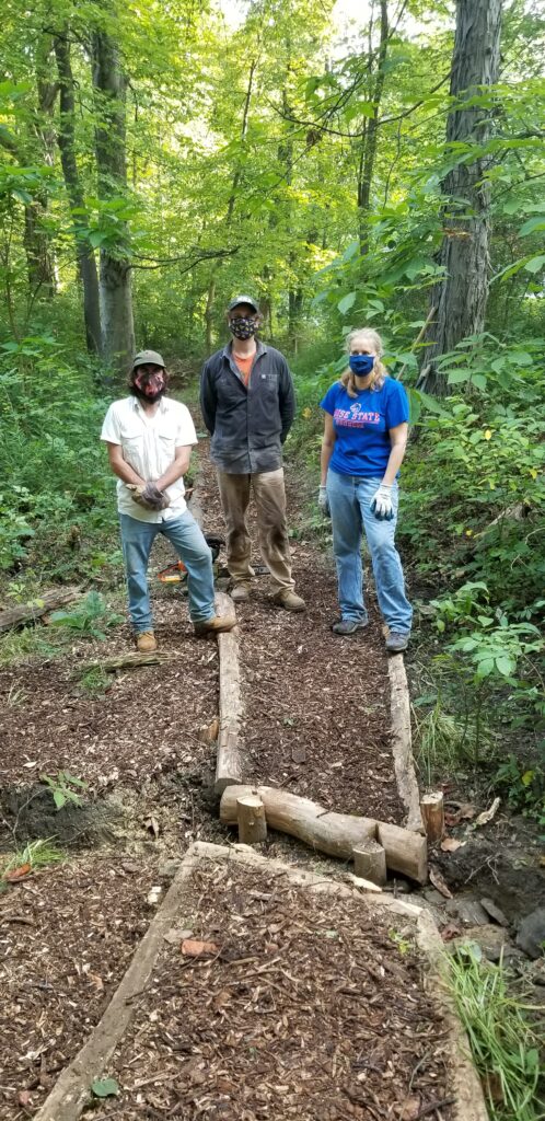
A newly completed trail that opened to the public earlier this month provides access to two of the Piney Creek tributary streams’ most scenic waterfalls — Little White Stick Falls and Cranberry Creek Cascades. The half-mile Waterfall Hollow Trail is the first of more than 20 miles of trail expected to open to hikers and bikers venturing into the 613-acre preserve in coming years.
Piney Creek Preserve, acquired by the West Virginia Land Trust in 2019, encompasses a 4.5-mile stretch of Piney Creek and much of the 600-foot-high northern wall of the gorge containing it.
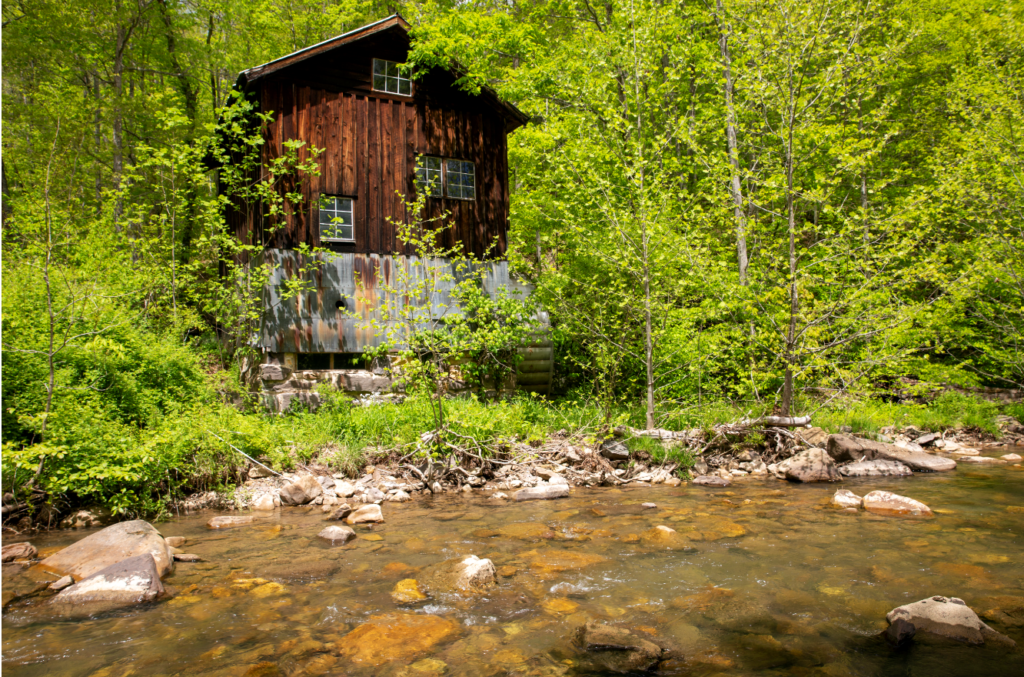
The land that makes up the preserve was heavily mined from the early 1900s to the 1970s. Remnants of its industrial past can be found throughout its boundaries.
“A gob pile once covered this area,” said Jesse Cecil, operations manager for the West Virginia Land Trust, after greeting volunteers arriving at the parking lot serving the preserve’s new Wildwood Trailhead, starting point for the Waterfall Hollow Trail and the nearly completed 4.3-mile-long Wildwood Trail.
As Cecil hauled a load of crushed rock to a damp stretch of Waterfall Hollow Trail, he passed a rock wall built in the early 1900s to stabilize a slope near the entrance to the Stanaford Mine, and, at a point just off the new trail, showed visitors the mostly filled-in mine entrance.
“This preserve is symbolic of an enduring landscape,” Cecil said. “Mining impacted every part of it. But 50 years after mining ended, it’s beautiful again.”
The preserve’s coal mining past will be embraced and interpreted, he said, and several former mine benches within the tract will be used to support trails, including the Wildwood Trail.
“While we’re a conservation organization, we recognize that coal mining is an essential part of our heritage, and we want to honor it,” Cecil said.
The long-abandoned coal camp of Stanaford, deep within Piney Creek Gorge, was the scene of the 1903 Battle of Stanaford, during which a posse of 50 armed men led by a deputy U.S. Marshal and the Raleigh County sheriff ambushed, shot and killed three striking miners and fatally wounded four more. Labor organizer Mother Jones visited the scene of the carnage the following day.
When completed, the Piney Creek Preserve’s trail system will include trails dedicated to mountain bikers, others reserved for hikers, plus several shared-use trails. Some will provide access to clifftop viewpoints, while others will guide climbers to bouldering and top-roping locales within the preserve, as well as to the shores of Piney Creek, noted for its brown trout fishing opportunities.
At the new Waterfall Hollow Trail, “we would eventually like to build an ADA accessible boardwalk, allowing everyone to view the falls,” Cecil said. When the trail system is complete, it will be served by two additional trailhead parking areas.
Eventually, the trail system will connect to Beckley’s Gray Flats Trail System, a 14.5-mile network of existing hiking and biking trails along the rim, and down a wall of Piney Creek’s canyon adjacent to the Land Trust’s preserve.
“We’re working on a trail now that will connect this trail to the Gray Flats trails,” said Gary Moorefield, the city of Beckley’s trail coordinator. “It’s my dream to eventually have a trail system with a link that goes all the way to the New River and connects with trails in the national park.”
“It’s projects like these that make Beckley a more attractive place for business,” said Cecil. “Beckley already has all the needed infrastructure, including high-speed internet. Having places right in Beckley where you can hike or mountain bike, climb rocks, go bouldering or fish for trout — all right on the doorstep of a national park — creates more of a draw for living and working here.”
The Piney Creek Preserve is a cornerstone of the Beckley Outdoors Economic Action Plan, which seeks to brand the city as a premiere outdoor recreation destination that celebrates Southern West Virginia’s Appalachian heritage.
“We couldn’t open this preserve without our partnership with the city of Beckley and a group of willing and interested volunteers,” Cecil said.
The week before the Waterfall Hollow Trail’s dedication, 25 ecology students from WVU Tech spent hours removing multiflora rose and other invasive species from the trail and trailhead parking area. A wood rail fence along part of the trail was the result of an Eagle Scout project.
Story by Rick Steelhammer at Charleston Gazette-Mail: https://www.wvgazettemail.com/news/chasing-waterfalls-piney-creek-preserve-opens-first-trail-to-public/article_d68bd9d0-cb6d-598e-a457-164436a2f12f.html
Conservation Partnership Brings New Recreation Opportunities Along Shenandoah River
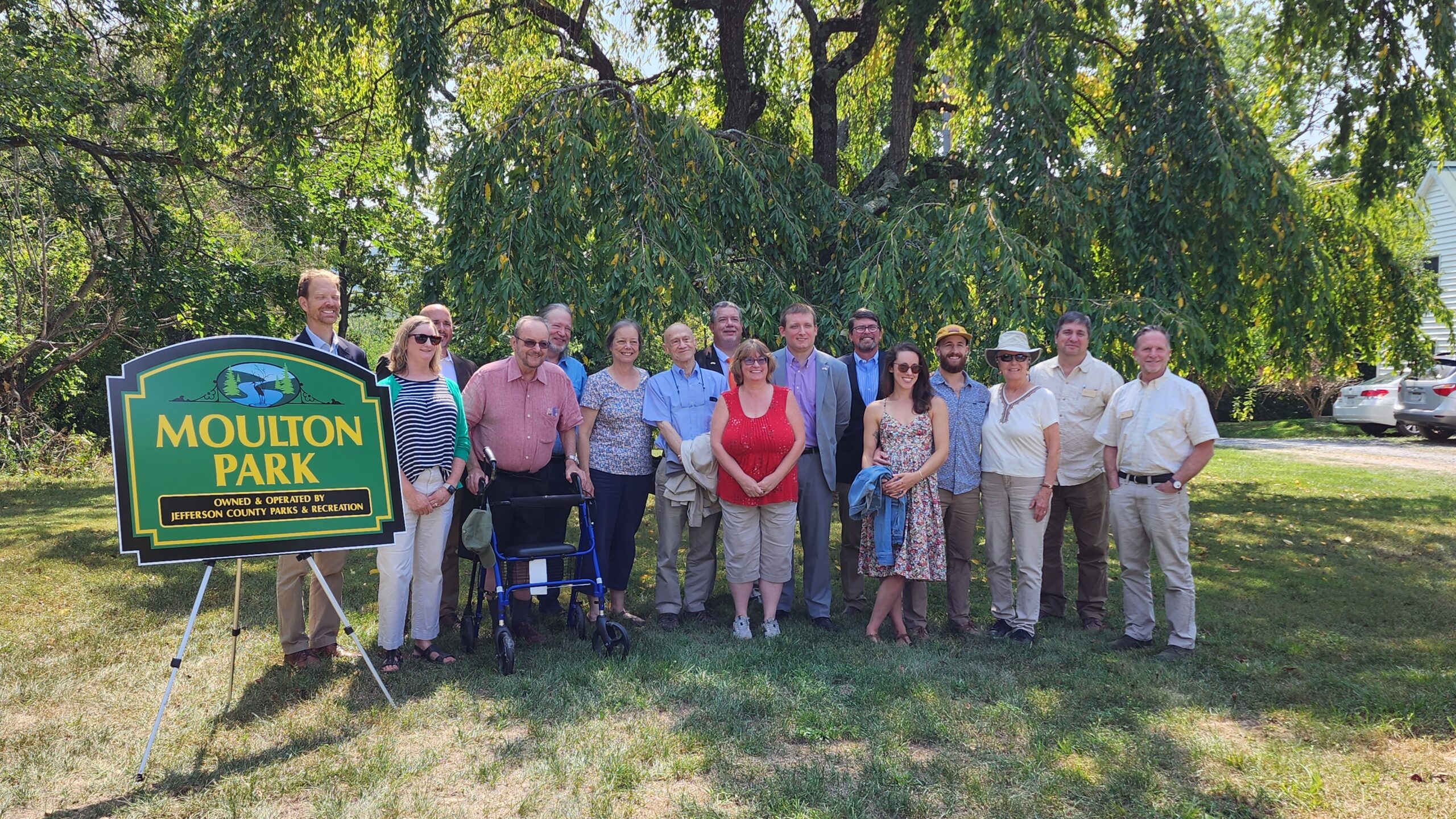
Charles Town, WV – Thanks to the generosity of the Moulton family, 82 acres of land have been added to Moulton Park along the Shenandoah River in Jefferson County, West Virginia. The family sold the property at less than fair market value, also known as a bargain sale, to achieve a conservation and recreation outcome for the community. Partners, including Chesapeake Conservancy, West Virginia Land Trust and Jefferson County Parks & Recreation Commission (JCPRC), worked together to secure public and private funds to support the acquisition of the property, including a significant grant from the West Virginia Outdoor Heritage Conservation Fund.
The Moulton family donated the original three acres of Moulton Park to JCPRC in 1976 to ensure ongoing public access and recreation. Almost 50 years later, the family’s generosity continued, and the June 2023 bargain sale of their adjacent 82-acre farm has now expanded Moulton Park. During this recent transaction, the West Virginia Land Trust also received a conservation easement on the property, which will protect it in perpetuity. This generation of the family added conservation goals, stipulating that the land be managed for watershed protection, education, native species protection and soil and forest regeneration, in addition to the family’s legacy of creating recreation opportunities and public access.
Following a formal planning process, the new parkland will include hiking trails, camping facilities and parking infrastructure to alleviate congestion and related issues along the Shenandoah River, one of 150 major rivers that flow into the Chesapeake Bay. These amenities will complement the existing outdoor pavilion designed and built by a family member in 2015.
“Four generations of our family have had the privilege of calling this beautiful piece of land home,” said Brucie Moulton. “We have all loved the place immensely and none of us could bear the idea of development, however profitable it might have been. We are grateful for the many partners who worked with us to craft a future for this property that emphasizes environmental protection and education—two core Moulton family values—and we are thrilled to know that the expanded Moulton Park will be enjoyed by the community for generations to come.”
“I’m thrilled to join the West Virginia Land Trust, Jefferson County Parks and Recreation and the Chesapeake Conservancy in celebrating the completion of the 82-acre expansion of Moulton Park,” said U.S. Senator Joe Manchin. “West Virginia is truly Wild and Wonderful, and this exciting expansion will promote outdoor recreation opportunities and boost tourism in Jefferson County and across the Mountain State. I can’t wait to explore the new parkland myself. I was proud to support this project, and as chairman of the Senate Energy and Natural Resources Committee, I will continue working to ensure West Virginia’s public lands and parks are protected for generations to come.”
“Moulton Park outside historic Harper’s Ferry is an iconic location for both our residents and visitors, and I was proud to advocate for the park’s expansion that we are celebrating today. West Virginia is recognized across our country for the natural beauty and splendor of our land, and today’s announcement will help continue that tradition here in the Eastern Panhandle,” said U.S. Senator Shelley Moore Capito. “I’m thankful for the work of Jefferson County Parks and Recreation, West Virginia Land Trust, West Virginia Outdoor Heritage Conservation Fund, and Chesapeake Conservancy for helping make certain this park will be a staple of our state for generations.”
“The generosity of the Moulton family is truly a model example of how we, as a society, can achieve success in this era of conservation,” said Chesapeake Conservancy President and CEO Joel Dunn. “Governments and nonprofits can’t do it alone. Our society needs the support of private philanthropists, such as the extraordinary Moulton family, as we race against time to adapt to climate change and protect 30% of the Chesapeake Bay watershed by 2030.”
“This project illustrates the dedication of local and statewide partners, bringing organizational strengths and resources to achieve conservation success,” said West Virginia Land Trust Land Programs Manager Ashton Berdine. “It also illustrates how one family’s love of land and home can leave a lasting legacy for all the people of Jefferson County to enjoy. This is a tremendous gift that keeps on giving.”
“The entire board of Jefferson County Parks and Recreation is so excited to see the property acquisition come to fruition,” said JCPRC President Toni Milbourne. “The Riverside property will provide a much-needed addition to the river access of Moulton Park as well as provide beautiful passive recreation opportunities for the residents of and visitors to Jefferson County. We could not be more pleased and look forward to enjoying this park for years to come.”
The Moulton Family, Chesapeake Conservancy, Jefferson County Parks and Recreation, and West Virginia Land Trust wish to thank Hogan Lovells US LLP for their legal counsel and work on this transaction.
About Moulton Park
Moulton Park has become one of Jefferson County’s premiere parks, with a half-mile of river frontage featuring camping and other recreational opportunities. A new public boat ramp was installed in 2012 and allows access for fishing the Shenandoah River. The park has campsites, picnic tables, a boat ramp, fire pits and parking access.
The park is a haven for native flora and fauna. The park’s expansion increased not only its acreage but also its connection to a diverse ecosystem, offering refuge to vegetation and wildlife species. In 2021, the West Virginia Department of Natural Resources conducted a biodiversity survey on the family’s farm. The survey concluded that two specific, imperiled species would benefit from an expanded forested buffer—the halberd leaved rose mallow (hibiscus laevis) and the northern red-bellied cooter (pseudemys rubiventris).
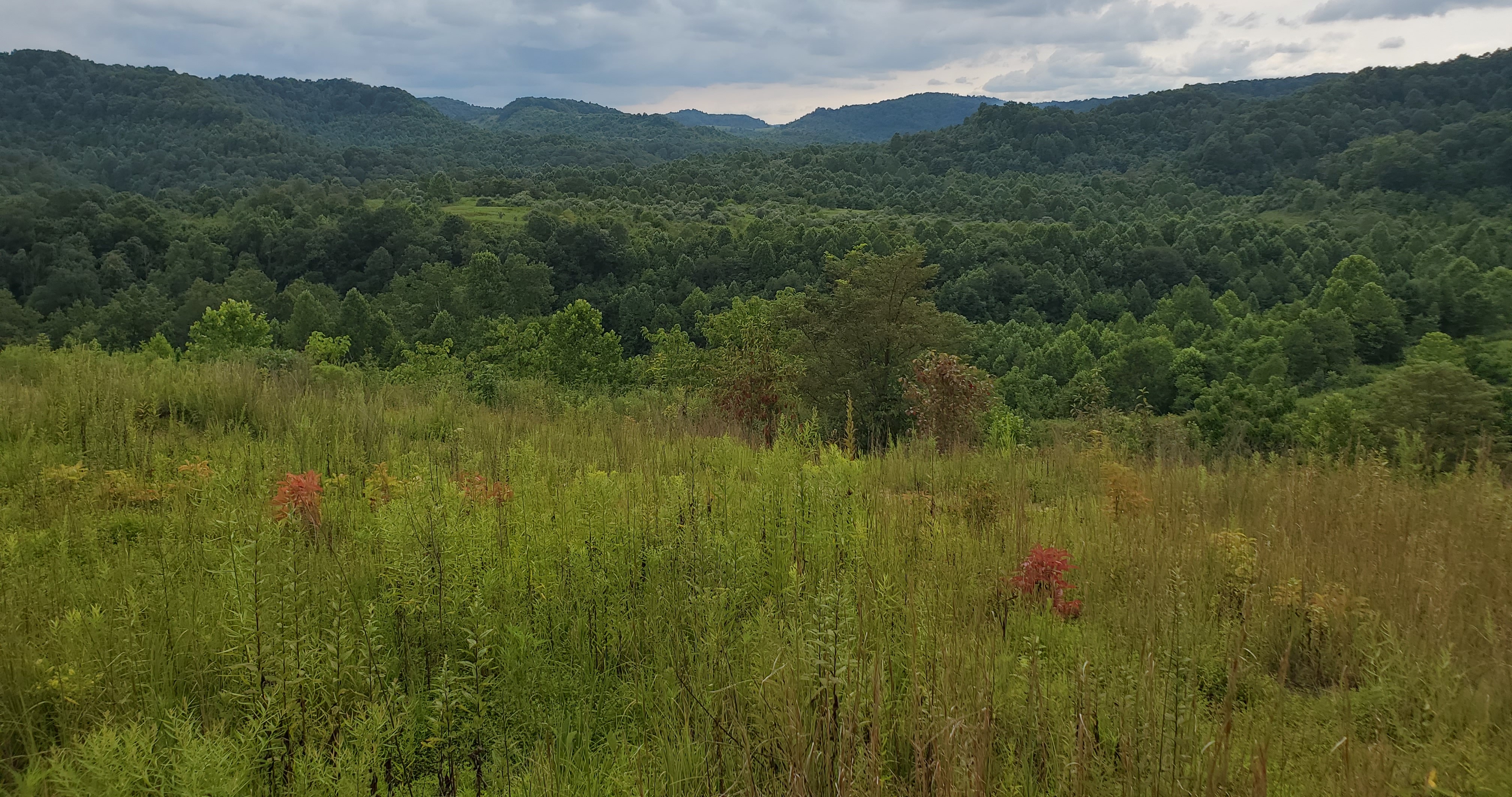
We are proud to announce that the West Virginia Land Trust received $2.8 million from a Congressionally Directed Spending request secured by Senator Joe Manchin III! This funding will allow WVLT to develop a multi-use trail system in the 5,000-acre Mammoth Preserve located in Kanawha County. Thank you, Senator Manchin, for working to secure this investment that will benefit West Virginians for many years to come!
We have Mammoth-size plans for this Mammoth-size place! WVLT is evaluating the recreational potential of this site for hikers, mountain bikers, equestrians, and other trail users. Working with the Upper Kanawha Valley Tourism Project, and specifically the City of Smithers and Montgomery WV, the Land Trust’s Mammoth Preserve will offer a destination that complements the riverside redevelopment of these small towns, aiming to reinvigorate the local economy with tourism visitation and to expand area residents’ opportunities for recreation.
The American Water Charitable Foundation, a 501(c)3 organization established by American Water, recently announced five organization in West Virginia, including the West Virginia Land Trust, have each received a 2022 Water and Environment Grant.
The West Virginia Land Trust (WVLT) has been awarded $26,338 in support of the Little Bluestone Community Forest project in Summers County. With these grant funds in place, WVLT plans to acquire the property in the fall of this year.
WVLT is leading the fundraising and land protection efforts to purchase 370 acres in Summers County for the purpose of creating a community forest. The land neighbors the National Park Service Bluestone National Scenic River and surrounds the Cooper’s Mill historic site owned by the Summers County Commission.
“West Virginia American Water is proud to support the Little Bluestone Community Forest project, as this land is located within our source water protection zone of critical concern, ” said Robert Burton, president, West Virginia American Water. “By conserving land that surrounds rivers and streams, we are protecting the drinking water for the community of Hinton.”
Funder support will allow WVLT acquire the forest and manage it for community benefits, providing additional public access and recreational opportunities on the Little Bluestone River while also protecting vital water supplies and wildlife habitat. Access to the site for regular public use will be subject to future development of access, parking, and trails.
In addition to receiving a grant from American Water, WVLT has accessed funding for this project from a variety of other funders including the Appalachian Trail Conservancy, West Virginia Outdoor Heritage Conservation Fund, and USDA Forest Service Community Forest Program – this project is the first awarded by the program in West Virginia.
“This project is valuable to the entire region as it not only impacts the city of Hinton, but also Summers County and Mercer County as the project develops. Future trails could tie into the Bluestone Turnpike Trail which will provide access from the Bluestone State Park and Pipestem State Park to the community forest and Cooper’s Mill. The hike is beautiful along the scenic river, making this a great destination for tourists,” said Jack Woodrum, State Senator and former Summers County Commission.
In 2020, the Summers County community approached the WVLT to partner on the purchase and preservation of the Little Bluestone property. Supporters of this community forest project include the Summers County Commission, State Senator Woodrum, Representative Miller, Senator Capito, Senator Manchin, National Park Service, Summers County Historical Society, City of Hinton, Hinton Area Foundation, Summers County Historic Landmark Commission, and the West Virginia Division of Forestry.
The Old Family Farm
March 3, 2022
Many West Virginians grew up on the old family farm – the place they worked, hunted, and played in the creek… the place they love. This love never leaves our blood… but sometimes life takes us far away from the old homeplace. One such place is Ed and Bettye DeBerry’s 110-acre farm in Marion County. A lot of good living and family memories happened here but now it is mostly just a quiet home for wildlife… which is exactly part of the legacy that the DeBerrys wanted to share with future generations. The family wanted the public to be able to enjoy their property and WVLT is pleased that the DeBerrys donated their farm and put their faith in our organization to ensure those wishes.
Located only 30 minutes from downtown Fairmont, the DeBerry Farm is a quiet and secluded landscape that is mostly wooded, but still has evidence of fields that once pastured cows and supported a garden. The trees on the hillsides surround the old homestead and guardian the farm from above. Old roads and trails traverse the forest and hold potential to be developed into hiking and biking trails. The farm borders the 600-acre Curtisville Lake Park and Campground, adding to a larger protected landscape—a benefit for wildlife and recreationists alike.
While it is WVLT’s obligation to preserve the natural features of the landscape, we also want to provide additional public benefits. There are lots of possibilities and we are considering ways to reinvent this old family farm—a place for new or veteran farmers, for parkland, trail development, outdoor education, and more. Until then, the farm is in good hands… err… hooves, claws, and paws… as the deer, birds, and opossums stand guard.
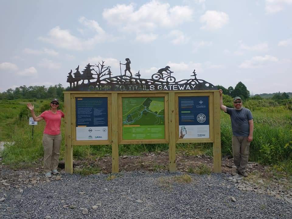
The West Virginia Land Trust (WVLT) owns the Yellow Creek Natural Area (YCNA) in Tucker County. Major support from The Center for Active WV facilitated the development of new kiosks, welcoming folks on their next adventure! We partnered with Blackwater Bicycle Association on an information kiosk at the Camp 70 Trails, which lead to YCNA. We also partnered with property neighbors at the National Youth Science Center and the West Virginia Division of Natural Resources to create new kiosks also directing you towards YCNA.
Special thanks to Mike Blackburn from Natural By Design, Lauren Lamb from Skull House Group, and Rolling, Tank & Fabrication who collaborated with WVLT on the design of the kiosks.
More information:
WVLT purchased the Yellow Creek Natural Area in 2019 with the support of four major grant funders, several local businesses, and 228 individuals from 19 states. The 860-acre property is home of the infamous “Moon Rocks” and contains 4+ miles of trails to Moon Rocks, HooDoo Rocks, and Yellow Creek, also linking to 20+ miles of the Heart of the Highlands Trail System. This property is permanently protected and open for public recreation.
The West Virginia Land Trust (WVLT) is leading the fundraising and land protection efforts to purchase 370 acres in Summers County for the purpose of creating a community forest. The land neighbors the National Park Service Bluestone National Scenic River and surrounds the Cooper’s Mill historic site owned by the Summers County Commission. In 2020, the Summers County community approached the WVLT to partner on the purchase and preservation of the Little Bluestone property.
“The community first impressed me with their passion for conserving the forest setting for the historic Cooper’s Mill. Then I was next surprised over and over by the beauty of the Little Bluestone River and its canyon. But I really fell in love with the idea of pursuing a Community Forest solution for protecting this land when I walked into the forest and found a healthy example of a Central Appalachian Forest teaming with native life,” said Amy Cimarolli, Land Protection Specialist for WVLT.
The USDA Forest Service has committed financial assistance to this community-envisioned project through a 2021 award from its Community Forest Program, the first awarded in West Virginia! This Community Forest Program project will help the WVLT to acquire and conserve the forest around Cooper’s Mill and manage it for community benefits, providing additional public access and recreational opportunities on the Little Bluestone River while also protecting vital water supplies and wildlife habitat.
Supporters of this community forest project include the Summers County Commission, State Senator Woodrum, Representative Miller, Senator Capito, Senator Manchin, National Park Service, Appalachian Trail Conservancy, Summers County Historical Society, City of Hinton, Hinton Area Foundation, Summers County Historic Landmark Commission, and the West Virginia Division of Forestry.
“This project is valuable to the entire region as it not only impacts the city of Hinton, but also Summers County and Mercer County as the project develops. Future trails could tie into the Bluestone Turnpike Trail which will provide access from the Bluestone State Park and Pipestem State Park to the community forest and Cooper’s Mill. The hike is beautiful along the scenic river, making this a great destination for tourists,” said Jack David Woodrum, State Senator and former Summers County Commissioner.
After acquisition of the property, the WVLT will continue to work with the landowners, the Summers County Historical Society, Summers County Commissioners, and other community supporters of the project, on a project development plan to manage the forestland for community benefits such as recreational trails, nature education, and historical interpretation of Cooper’s Mill. This will include working with the National Park Service to initiate review of creating a potential trail connection to the Bluestone Turnpike Trail.
Access to the site for regular public use will be subject to development of access, parking, and trails. Those interested in supporting the campaign may donate at www.wvlandtrust.org/donate and designate your gift to the Little Bluestone Community Forest project.
WVLT is a statewide nonprofit organization dedicated to protecting West Virginia’s special places forever. Since 1994, the organization has protected nearly 20,000 acres of land, creating outdoor recreation opportunities, safeguarding our drinking water supplies, protecting scenic views, preserving historic sites and family farms, and much more.


In honor of Earth Day, the Mon Valley Green Space Coalition (MVGSC) and the West Virginia Land Trust (WVLT) will host a “Touch the Earth Festival” from 1 to 4 p.m. on April 17 at the pavilion in Marilla Park. The event is free and open to the public.
Other organizations, including Friends of Deckers Creek, the Mon River Trails Conservancy, Recycle Right Morgantown, the Mon chapter of the Sierra Club, and members of Morgantown’s Green Team, will also participate in the event.
The Festival will include educational activities by members of participating organizations, including guided tours of Marilla Park’s new trail, a tree-planting party, and a scavenger hunt in which participants will learn to identify trees and plants. Attendees will have the opportunity to learn everything from how to build a sustainable hiking-and-biking trail to how to spot and avoid poison ivy. Trees on the trail route will have signage with information about their ecological and financial benefits, particularly as they relate to easing the adverse effects of climate change.
Guided tours of the new trail will be given at 1:30 and 3:30 P.M., and the tree-planting will occur at 2:30 P.M. Throughout the festival, information on recycling, the rail-trails, the WVLT’s Toms Run Preserve, and the proposed Morgantown southern greenbelt will be available.
“From an ecological perspective, it’s crucial to preserve and protect green spaces,” said JoNell Strough, a WVU professor of psychology and the chair of the MVGSC. “Their positive impact on air and water quality can’t be overstated. Green spaces are also essential to the overall physical and mental health of a community. They provide recreational opportunities as well as peaceful, restorative retreats from our hectic day-to-day lives.”
One of the aims of the Touch the Earth Festival is to highlight the possibility of a greenbelt around the city, which would enable residents to move around town without resorting to motorized transportation. Representatives from the MVGSC and the WVLT have been in active talks with the city to establish more connector trails, such as the new one in Marilla Park, to link neighborhoods to city parks and the rail trail.
“Morgantown is one of three West Virginia cities that have been chosen for a remote worker program that will highlight outdoor activities,” said Rick Landenberger, a WVU geography professor, MVGSC board member, and the science and land management specialist for the WVLT. “With a greenbelt, our community would be even more attractive to people and businesses that want to make Morgantown their home.”
Sponsors of the Touch the Earth Festival recommend that guests who wish to participate in tree- planting activities wear long pants, long-sleeved shirts, and gloves (so as to avoid contact with poison ivy) and bring shovels, if they have them. (Some shovels and other tools will be available for public use.) In keeping with the state’s Covid guidelines, festival organizers and participants will wear masks and maintain appropriate social distances.
The festival will occur rain or shine.
For more information on the festival and to learn more about the WVLT, visit www.wvlandtrust.org. More information about MVGSC can be found at www.monvalleygreenspace.org. You can also find both organizations on Facebook at @wvlandtrust and @greenspacecoalition.
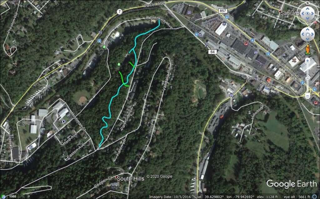
The West Virginia Land Trust, in partnership with the Mon Valley Green Space Coalition, BOPARC, and the City of Morgantown, are pleased to announce the creation of Morgantown’s newest public trail – the Marilla Park Connector. The trail is just over 0.5 miles in length and greatly improves access to Marilla Park from the South Hills neighborhood. As a critical link in a larger connector trail system that will connect Greenmont to Marilla and the Deckers Creek Rail-Trail, the trail has been “a labor of hard work and love” according to Dr. Rick Landenberger, WVLT Science and Land Management Specialist who designed the trail and led the volunteer groups.
Dr. Brent Bailey, West Virginia Land Trust Executive Director and local trail advocate points out that “Local trails are one of the most popular community features that people look for when deciding where to live. The West Virginia Land Trust supports their development, and not just on its own properties. This connector works on so many levels: for recreation, for education, for alternative transportation. Morgantown is lucky to have the properties and the people that make this possible.”
The idea to better connect the southern neighborhoods of Morgantown to the Parks and Rail-Trails started two decades ago when Greg Good, then President of the Mon Valley Green Space Coalition, and Landenberger, then a Ph.D. student in the WVU Forest Resources Science program, began scouting the area for possible routes from the local neighborhoods to schools and parks. Recently, Landenberger picked the project back up, forming a partnership with the Mon Valley Green Space Coalition, BOPARC, and the City of Morgantown
According to Assistant City Manager Emily Muzzarelli “We’ve been continually working to expand our trail network and enhance outdoor recreation in the City. Now, more than ever, we see just how important these resources are to the community. It has been fantastic to see the efforts from volunteers and citizens to complete this project in Marilla Park.”
Landenberger began working in summer 2016 with young volunteers from the BOPARC YETI (Youth Engagement Through Involvement) Summer Camp program. Other volunteer groups include the Charlie’s Angels Hash House Harriers and WVU iServe students.
“Success in many areas is largely dependent upon partnerships such as the one represented by this project. This trail is a wonderful addition to our City park system and we are excited to share it with the community”, said BOPARC’s Director Melissa Burch.
“Cooperation among the partners facilitated the timely completion of this trail project,” commented Dr. JoNell Strough, current chair of the Mon Valley Green Space Coalition. “By working together, we built a trail that not only serves community needs for transportation and recreation, but also provides a space for people to put their cares aside as they take in the beauty of the forest.”
For more information, contact WVLT Land Management and Science Specialist Rick Landenberger at rick@wvlandtrust.org.
“We call this land OMG Acres. OMG stands for ‘Ouellette, Mueller, Glasson’ – the last names of the three co-owners – and it also stands for ‘Oh My Gawd’ for the sanctuary it offers from society’s craziness that too often carries us away from what is truly important and meaningful. This land is beautiful and peaceful in all seasons. Our goal is to protect, preserve and expand this land and its wildlife. As these beautiful lands and wildlife become more threatened by encroaching development, subdivisions and mining, this land should continue to evolve as a place supporting healthy ecosystems, forest land, biodiversity, and wildlife habitat while also allowing sustainable farming when needed now and into the future,” said Mark Mueller, one of the owners of OMG Acres.
Together, three landowners – Mark Mueller, Avery Ouellette and Dan Glasson – approached the West Virginia Land Trust (WVLT) early this year in hopes to protect their farm in perpetuity. With a conservation easement, the WVLT can do just that. This property is now the second conservation easement held by the WVLT in Pendleton County.
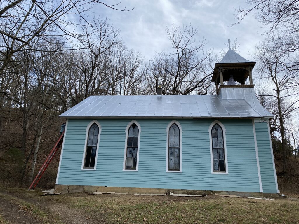
OMG Acres is comprised of 330 acres along the South Fork River (which flows into the South Branch of the Potomac), with a mosaic of open fields and woodlands. It includes three historical structures – an old farmhouse, log cabin, and church – which the landowners are in the process of renovating and hope to preserve. In addition to these structures, the easement protects ½ mile of river frontage and defined buffer areas along streams. The property is the most upstream of three other WVLT-conserved sites along the river. This project also protects biodiversity including wood turtles, Virginia big-eared bat, and a sandstone “pavement” pine habitat.
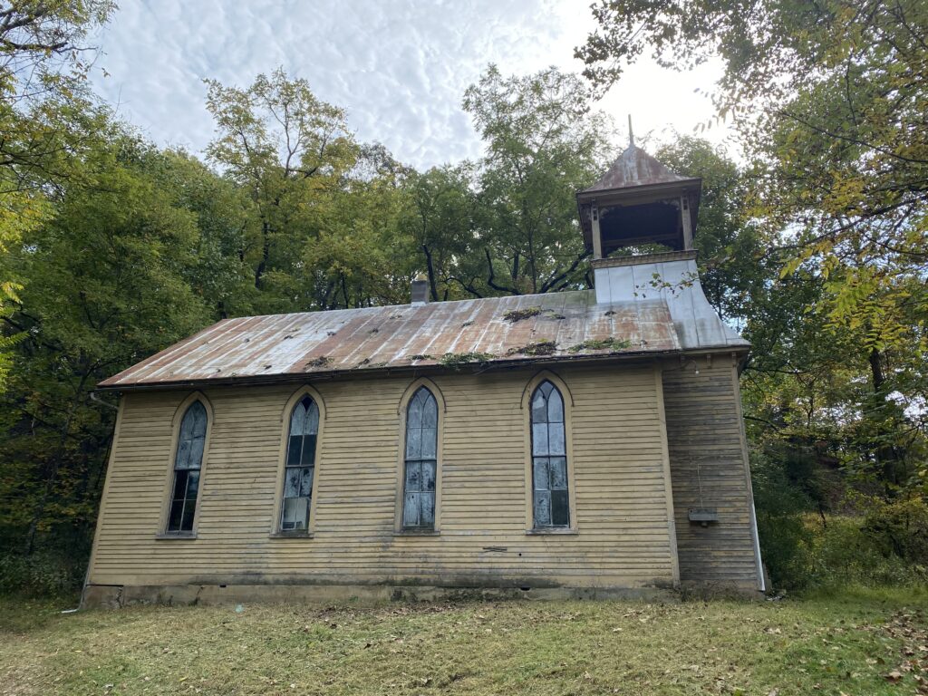
(Church restoration project. Photo above is the “before” and photo below is the “after!”)
The farm has been their refuge during the pandemic. “We feel immensely grateful to have access to this beautiful property that allows us to continue enjoying our outdoor passions while isolating from others,” shared Avery Ouellette and Dan Glasson. “Watching the daily rhythms of nature and spending time each day working on projects to preserve the unique features on this property have given us a much-needed respite.”
Working on the conservation easement during this time period also allowed Mark, Avery, and Dan to look beyond the daily challenges of COVID-19 and think about their future legacy. This was particularly important given that Mark was diagnosed with cancer in the Spring. “We can’t thank Amy Cimarolli and WVLT enough for their thoughtfulness and dedication in helping us realize our shared conservation goals. We are also so grateful for the support of Severn Bank and their willingness to work with us in putting this conservation easement in place on our property. We are thrilled that the land will be conserved long after us.”
When asked about Severn Bank’s involvement with conservation projects, President and CEO Alan Hyatt stated, “Since Severn Bank is headquartered with all of its operations in a fragile environment, we realize what is at stake with the health of the Chesapeake Bay, the water ways, connecting lands, our environment, and the many surrounding states that are affected by its health. We feel we have a responsibility to do our part to preserve our natural resources, and we take this responsibility very seriously. This includes Severn’s Westgate Circle headquarters with a state-of-the-art “green roof” that captures and absorbs runoff water that would typically challenge our infrastructures and pollute our waterways. We also show our support with frequent donations to many environmentally oriented organizations, backing people and organizations who share our love of the land and water, and protecting properties for future generations.”
The purpose of conservation easements is to protect forests, scenic beauty, wildlife habitats, and working farms in perpetuity by placing permanent restrictions on the property. All of these values are protected at OMG Acres. In addition, the landowners committed to keeping trees growing along the banks of the South Fork to support clean water in the Potomac River, which benefits neighbors downstream.
Conservation easements are specifically tailored to meet the needs of each landowner; few conservation easements look alike because few properties are the same, and few landowners want exactly the same provisions. WVLT specifically tailors its conservation easements to meet the goals of the landowners and maintains a life-long authority and obligation to enforce the terms of the easement in perpetuity. Landowners still own their property and may use, sell, or leave it to heirs, but the restrictions of the easement stay with the land forever.
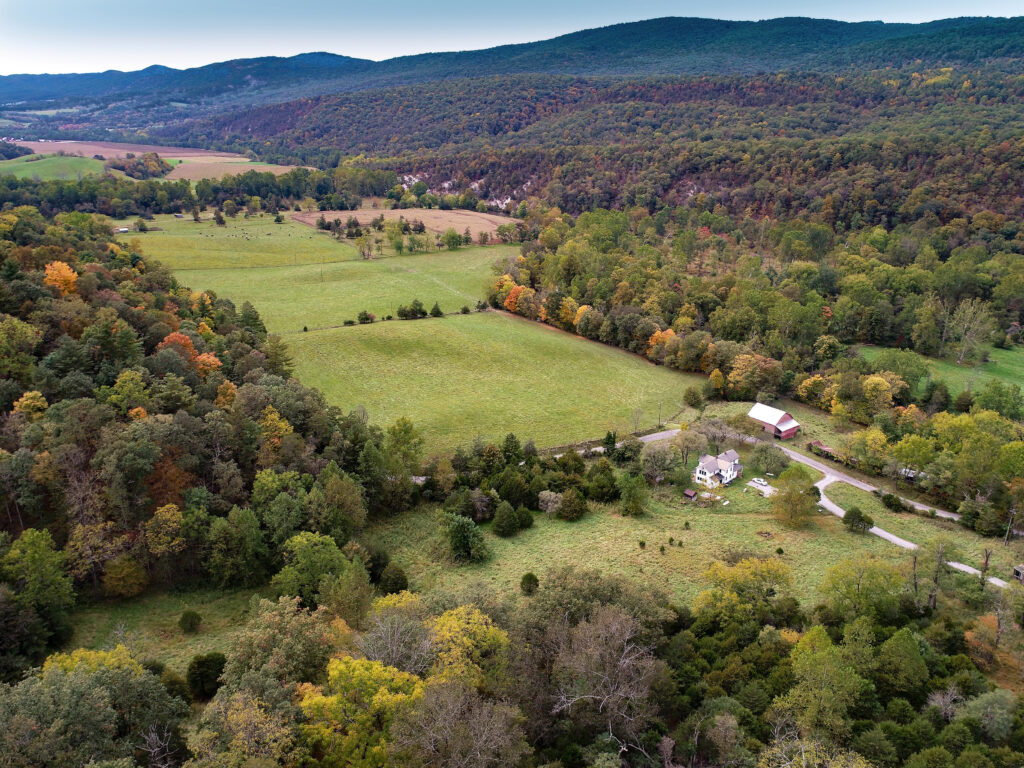
Steve Callen currently owns Cliff Canyon and had a desire to keep this place wild, undeveloped, and protected forever. He convened three of West Virginia’s conservation organizations and asked for help and advice in achieving his goal. The West Virginia Land Trust, The Nature Conservancy, and the Potomac Conservancy joined forces to bring this vision to completion. The property remains privately owned, but its conservation features are permanently protected by a conservation easement.
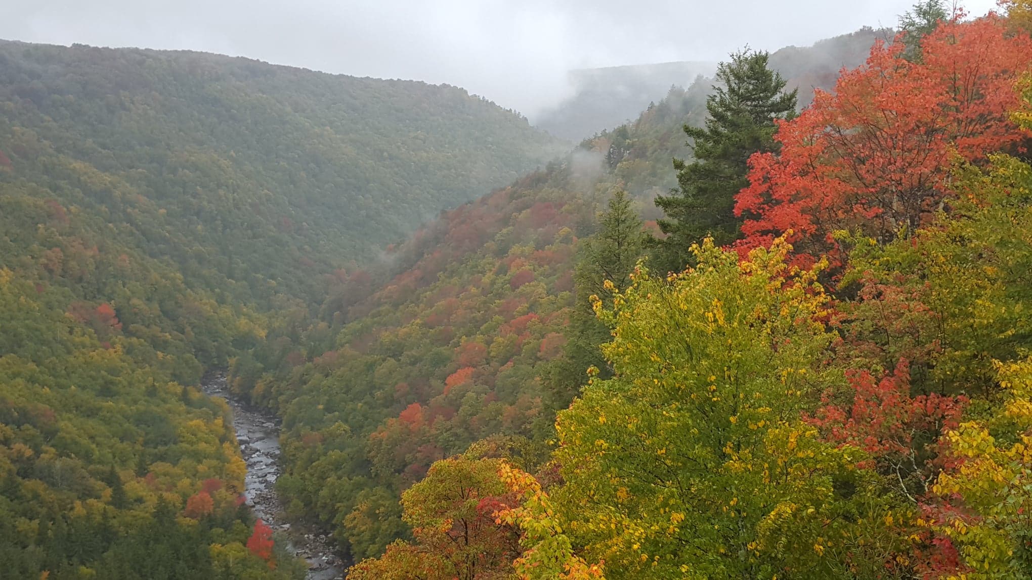
Located about 20 miles south of Moorefield, near Milam, in Pendleton County, Cliff Canyon is mostly comprised of limestone. The limestone geology forms rich soils and, combined with very steep slopes and its location in the “rain shadow” of the Appalachian Plateau, a very dry and harsh environment is created where only specific plants and animals are best adapted to survive. River enthusiasts and kayakers may know this site by its other name, Moorefield Gorge, challenging its Class 2 and 3 whitewater in the spring of the year.
“The Nature Conservancy, West Virginia Land Trust and Potomac Conservancy share a vision of protecting West Virginia’s important and special places. Together, we are working to provide a backdrop that makes people want to live, recreate and enjoy the natural wonders of our great state,” said Mike Powell, TNC Director of Lands. He went on to say, “TNC is happy to work on another project with the WVLT where both conservation and West Virginia win by protecting habitats of rare and unique species in an important landscape for nature-based recreation and tourism.”
“I believe that we are all called upon to be good stewards of all life. While there are many environmental threats, it seems clear that the single greatest threat to nearly all life except man is the lack of suitable habitat. I consider it a great privilege to be able to participate in the permanent protection of a unique and relatively undisturbed habitat that supports a large suite of terrestrial and riparian species. The legal protections provided by the easement combined with the onsite physical barriers give me confidence that, at least in this unique canyon, life as intended can continue toward perpetuity,” said Steve Callen, owner of the property.
Biologists and kayakers have known about the property, but the hillsides are so steep that most people rarely venture into this rugged canyon on the South Fork River in Pendleton County. Biologists were eager to see the canyon protected because of the many globally rare plant communities, such as the Southern Appalachian Northern White Cedar Woodland (less than five known occurrences worldwide), and the habitat to many other rare species associated with this dry forest type. The federally threatened Virginia big-eared bat is also known to reside in this remote place, adding to the critical need to keep this location protected. In total, 18 rare species and plant communities occur here, largely due to the limestone geology.
“Cliff Canyon is one of the most exciting places I’ve seen in the Appalachian region, and to find it nestled just out of sight on a common country road is remarkable. I’m thrilled to see this team come together to permanently protect such an extraordinary property,” said Emily Warner, Senior Director of Land Conservation at Potomac Conservancy.
This Cliff Canyon property also secures over three miles of river habitat, protecting water quality, aquatic species, and riparian habitat. West Virginia’s headwater streams (such as the South Fork River) supply clean drinking water to many people downstream. Conservation partnerships and conservation projects like Cliff Canyon benefit nature and people in so many ways.
The Nature Conservancy, West Virginia Land Trust and Potomac Conservancy each played a key role in securing the financial resources and stewarding the project to completion. The three organizations jointly applied to the West Virginia Outdoor Heritage Conservation Fund (OHCF) for financial assistance to protect the Cliff Canyon site.
In 1985, the West Virginia Legislature created the OHCF to invest in the conservation of unique and important wildlife habitats, natural areas, forest lands, farmlands, and lands for hunting, fishing and recreation. The OHCF receives applications from qualified conservation organizations for projects like Cliff Canyon each year.
“This project encompasses so many good qualities, but what stands out to me is the ruggedness of the land and the solitude one feels in this canyon. It is nice to know it will always stay and feel this way,” says Ashton Berdine, Lands Program Manager for WVLT.
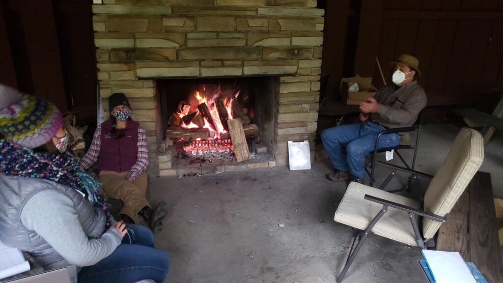
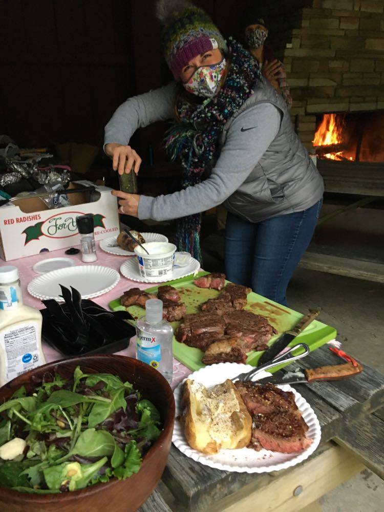
Reunited and it feels so good! After six months of working from home, the West Virginia Land Trust had our first in-person staff meeting. We wore our masks, used hand sanitizer, met outside, and enjoyed lunch over an open fire. This year has been a huge adjustment for us to “shelter in place”… I mean come on… we are outdoor people, what does staying home even mean?!
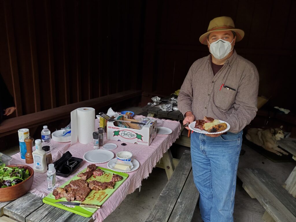
This is our new normal and we are adjusting. We have worked remotely, held Zoom meetings with folks from all over the country, and met outside in small groups when necessary. Our recent virtual Special Places Celebration allowed us to connect with people from all over the country and they showed up in a big way – donating to help us continue our important work.
Speaking of Special Places… our title sponsor Bailey & Glasser along with the WVLT Board of Directors offered to match all gifts up to $20,000. We are only $5,000 short of our goal! They extended the deadline through this Sunday, Oct. 4. Can you help us out? Make a donation today at www.wvlandtrust.org/donate to support our important work.
Hope to see you outside soon!
Jessica Spatafore
WVLT Director of Development & Communications
 Protect Your Land