In September 2020, WVLT purchased 13.5 acres in Jenkinsburg for permanent public access from its long-time private owners, Dave and Cynthia Hough.
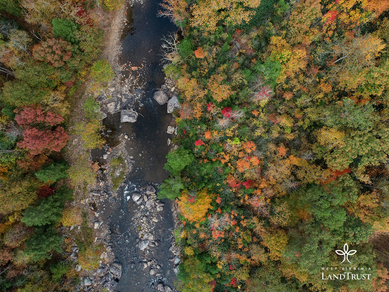
The property is tiny in relation to the extensive wild lands now protected in the area but is a keystone piece of property, for river and trail recreation that is rapidly growing in north-central West Virginia.
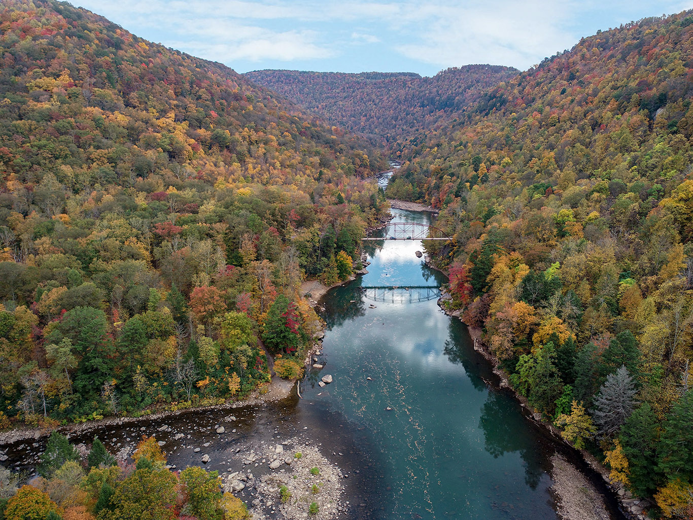
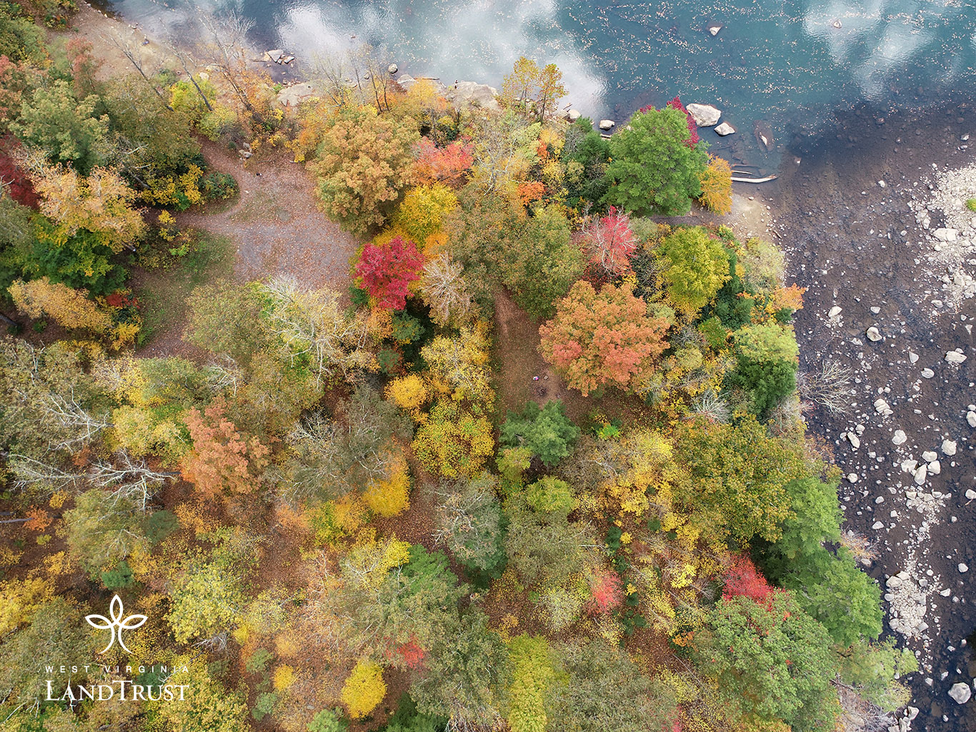
Situated at the confluence of Big Sandy Creek and the Cheat River, the property is also an access point to the Allegheny Trail, West Virginia’s longest hiking trail, a 330-mile north-south path with the northern terminus at the Mason-Dixon line at the Pennsylvania-West Virginia border near Bruceton Mills. To the south and east are public lands of the Cheat Canyon Wildlife Management Area, managed by the West Virginia Division of Natural Resources, with trails under development by Friends of the Cheat (FOC), a local watershed association.
Check out this interview with Charlie Walbridge – river champion!
As part of our Special Places Celebration, WVLT Executive Director Brent Bailey interviewed Charlie to announce our Jenkinsburg purchase! Charlie is on the Friends of the Cheat Board of Directors, Whitewater Paddler, Cheat River Enthusiast, Whitewater Safety Expert, and longtime Safety Chair for American Whitewater… This guy knows water!!
Getting there: The Jenkinsburg Recreation & Natural Area is very remote and road conditions can vary depending on the season. High clearance vehicles are recommended. Roads are not maintained in the winter and visitors should be aware that icy road conditions may persist longer than other locations.
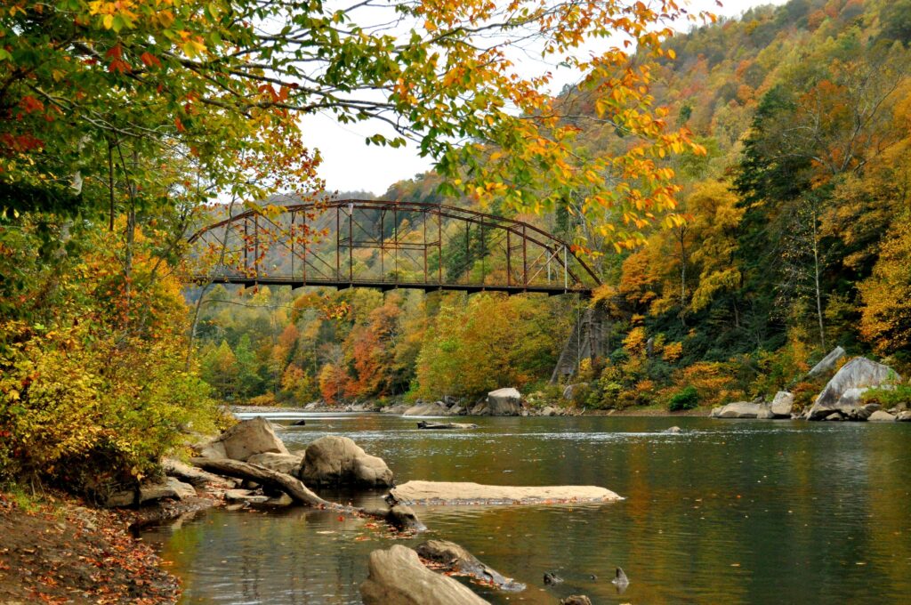
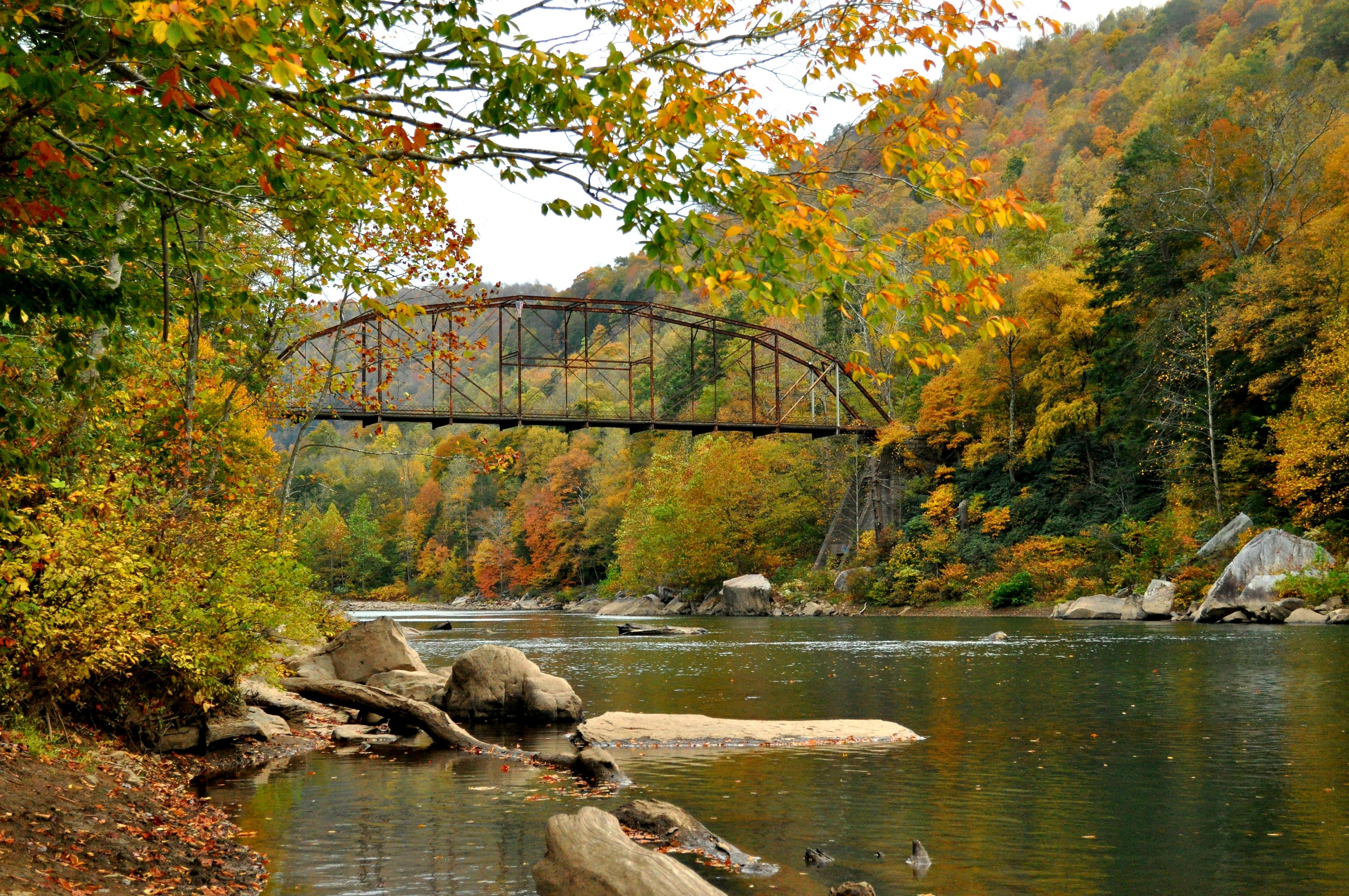
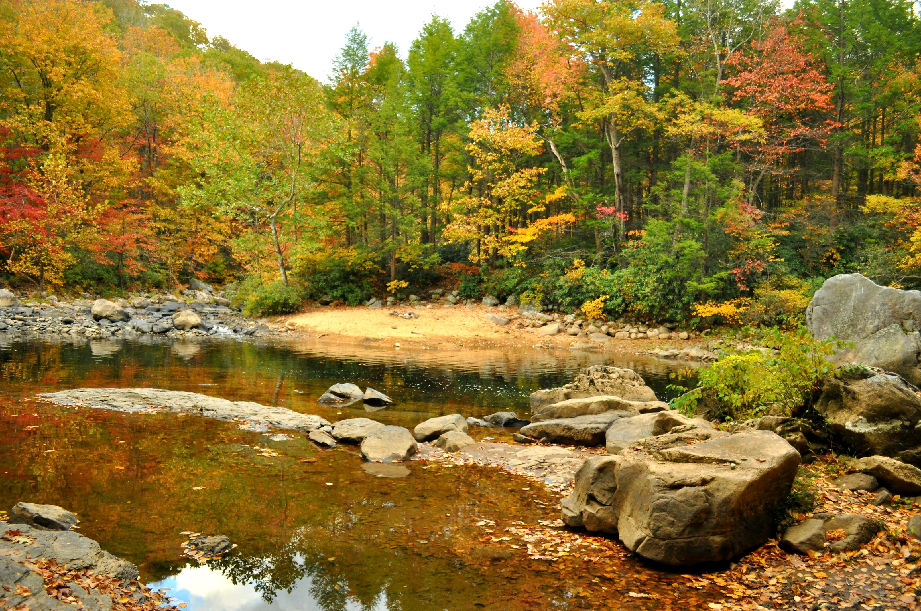
The Jenkinsburg tract is well-known for its “high bridge”, and swimming areas along the Cheat River and Big Sandy Creek, including “Blue Hole”. WVU students, locals, whitewater enthusiasts, hunters, and hikers frequent the area.
Historically, Jenkinsburg was a small a logging town. The Jenkinsburg Bridge was built in 1912 by the Canton Bridge Company, and is an example of a rare design, known as a pin-connected Pennsylvania through-truss bridge. Canton Bridge Company became American Bridge Company, one of the nation’s biggest bridge-builders during the early 20th century and has numerous structures listed on the National Register of Historic Places. A corner of the property abuts the bridge.
We are partnering with Friends of the Cheat on the site management. Please support this effort by donating today and selecting Jenkinsburg Recreation Area on your gift designation.

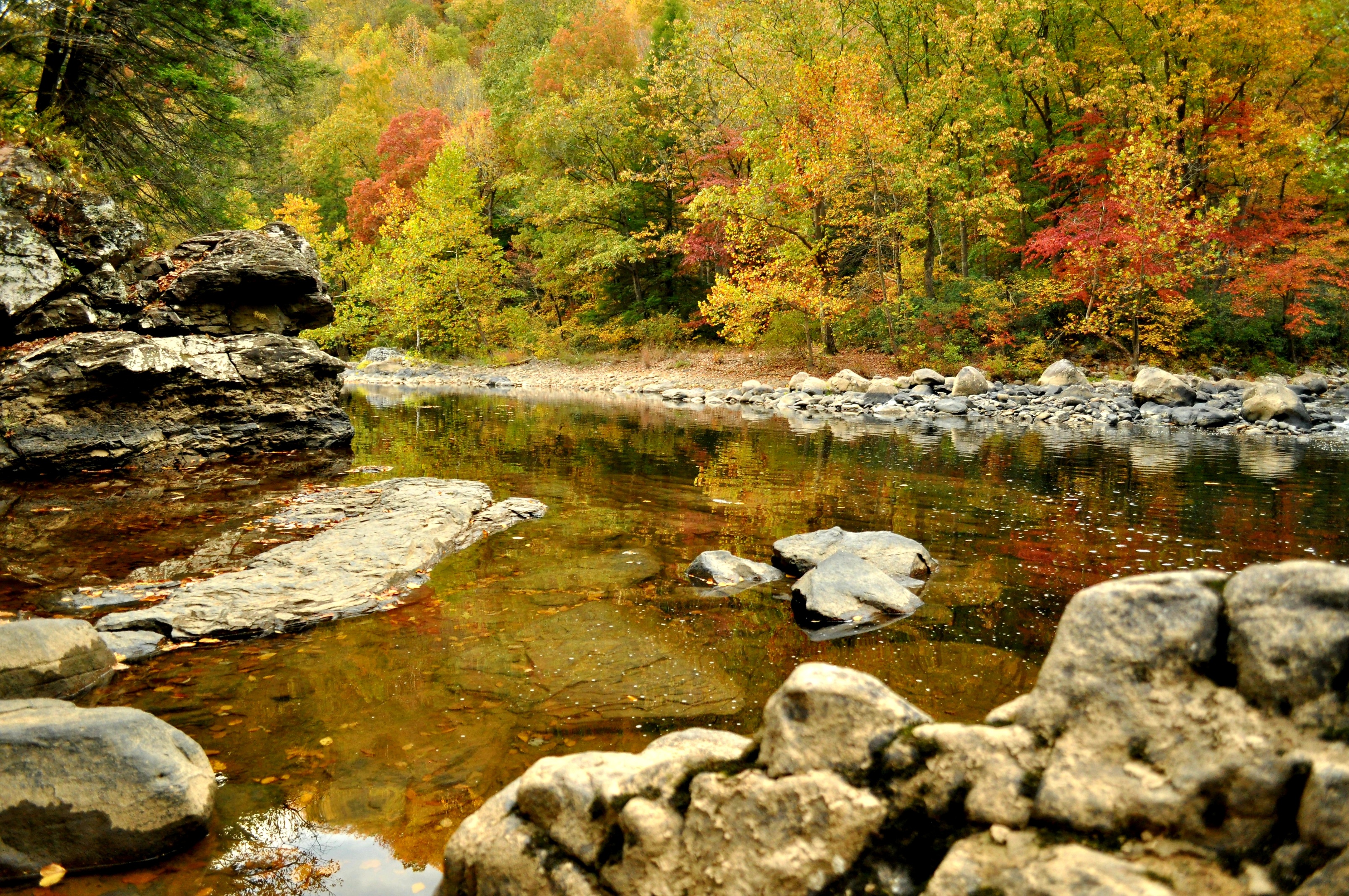
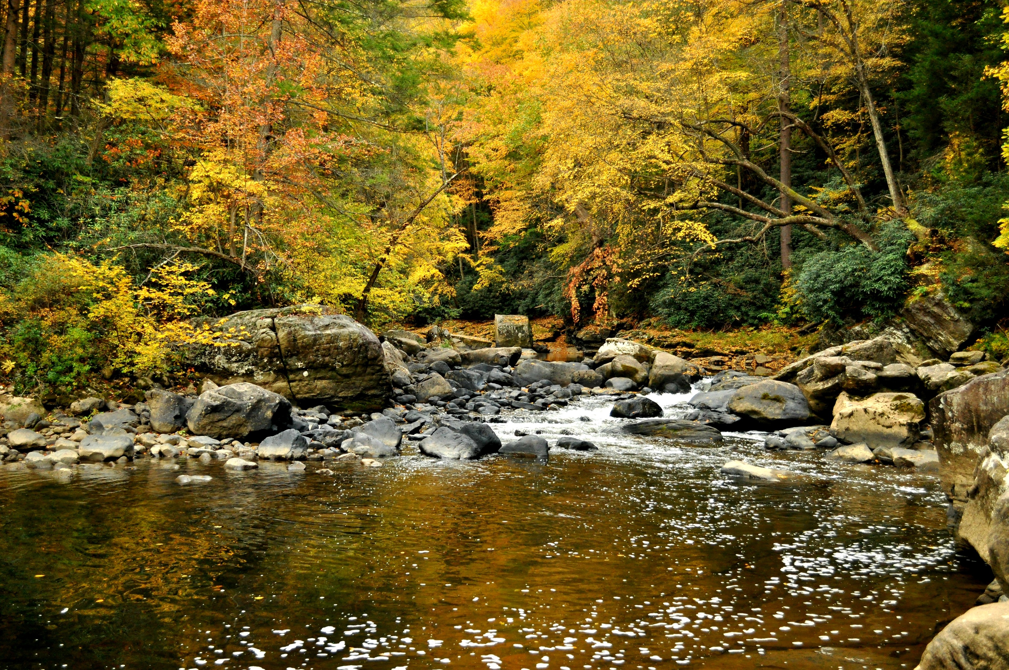
Whitewater: Both whitewater sections of the Cheat River (Cheat Canyon) accessed from Jenkinsburg, as well as Big Sandy Creek, are rated for experienced paddlers only. These sections include technical whitewater and are extremely remote / inaccessible.
Learn more about these whitewater runs on the American Whitewater website:
Cheat Canyon (Albright to Jenkinsburg)
Cheat Canyon (Jenkinsburg to Cheat Lake)
Big Sandy Creek (Rockville to Jenkinsburg)
[smart-grid row_height=”300″ fixed_height=”true” last_row=”justify” margins=”0″ randomize=”true” captions=”false” font_type=”google” google_font=”Roboto” font_weight=”300″ title=”false” zoomable=”false”]
#gallery-1 { margin: auto; } #gallery-1 .gallery-item { float: left; margin-top: 10px; text-align: center; width: 33%; } #gallery-1 img { border: 2px solid #cfcfcf; } #gallery-1 .gallery-caption { margin-left: 0; } /* see gallery_shortcode() in wp-includes/media.php */

[/smart-grid]
 Protect Your Land